Itinerary
Follow in the footsteps of the Romans and the vaqueiros. A historic route that connects the town of Moal with the Leonese plateau through an impressive mountain pass.
Route Description
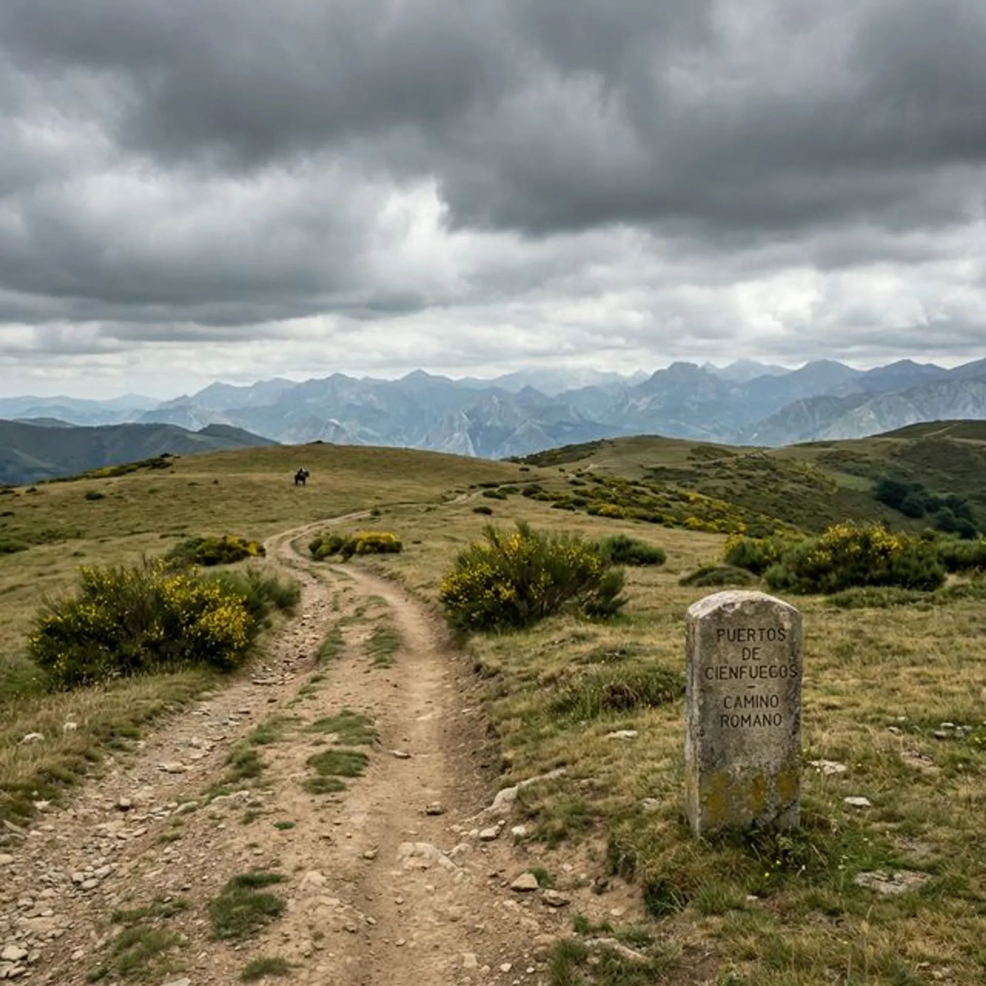
The Cienfuegos Ports Route is a journey through the history of communication between Asturias and León. Before modern roads, this pass was a vital artery for commerce and transhumance.
The route usually starts in Moal. After a first section shared with the road to Tablizas (the entrance to Muniellos), we turn off to begin the ascent. The path is wide and comfortable, flanked by a mixed forest that at high altitudes gives way to brooms and high altitude pastures.
Upon reaching the brañas, the landscape opens up immensely. We are in high mountain territory, where the wind blows strongly. The Port of Cienfuegos is a natural window: to the north, the sea of clouds and forests of Asturias; To the south, the aridity and plains of León and the Babia region.
💡 Practical Tips
- Water: It is a long route, take plenty of water.
- Sun: There is no shade in the upper part. Essential sun protection.
- Bike: It is a very cyclable route (wide track), although with a constant gradient.
- Fauna: It is a passage area for bears and wolves. Keep your eyes open.
📸 Key Points
- The contrast between the closed forest and the open ports.
- The views of the Ubiña Massif in the distance.
- The feeling of loneliness and isolation.
Itinerary
Inicio en Moal (pista hacia Tablizas).
Desvío hacia el valle del río Muniellos.
Ascenso constante por bosque de roble y haya.
Llegada a las brañas de Cienfuegos.
Coronación del Puerto de Cienfuegos (límite con León).
Vistas espectaculares y regreso por el mismo camino.