

The route
Map and profile
- Ascent738 m
- Descent68 m
- Highest2,152 m
- Lowest1,460 m
Elevation profile (one way)
Use two fingers to move the map
Track based on OpenStreetMap (© its contributors, ODbL licence); elevation from the Copernicus EU-DEM model. For guidance only: always follow the waymarks.
About the route
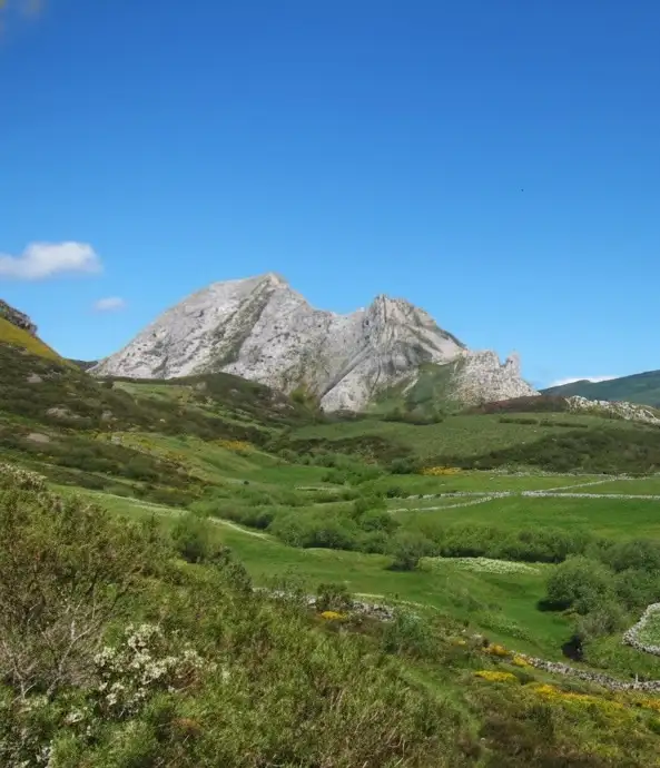
Crowning the roof of Somiedo. A classic high mountain ascent to 2,194 meters of Pico Cornón, crossing subalpine landscapes and bear and chamois habitat.
Route Description
The climb to Cornón is the queen of mountaineering routes in Somiedo. Being the highest point of the council, it offers an unparalleled visual reward, but requires corresponding physical effort.
We start in Santa María del Puerto, a vaqueiro village par excellence. The first kilometers are a pleasant walk along a track that goes up the Bayo River valley. We soon reach the Veiga Cimera, an idyllic place where the river forks into two streams and it is easy to surprise chamois grazing on the slopes.
From here, the landscape changes. We enter the Vega Mozarra, a high mountain terrain characterized by limestone rock and low scrubland (heather, blueberries), dotted with small lagoons and peat bogs. The slope becomes progressively harder.
The final assault on the summit is carried out along its southern slope, overcoming a considerable slope until reaching the geodesic vertex. From 2,194 meters, the view is superb: to the east the Las Ubiñas massif, to the west the Ancares and the Lugo mountains, and to the north, on clear days, the blue line of the Cantabrian Sea.
💡 Practical Tips
- Orientation: In the Vega Mozarra area it is easy to get lost if there is fog. Avoid the route if the forecast is poor.
- Water: Once you have passed the Veiga Cimera, water is scarce. Carry sufficient supplies.
- Winter: With snow, the route requires crampons and ice axe; The wind usually forms ice sheets.
- Wildlife: You are in sensitive brown bear territory. If you see one, keep your distance and enjoy the sighting with binoculars.
📸 Key Points
- The Veiga Cimera, where the river forks into two streams.
- Color contrasts in autumn (reds of blueberries and yellows of grass).
- The immensity of the Cordillera from the summit.
Route
Waypoints
Guided experiences
Guided tours


Booked on GetYourGuide; each activity shows its cancellation policy.
Where to stay
Accommodation in Somiedo




The full Somiedo guide
Somiedo has its own website, with more detail than fits here:
Keep exploring


