

The route
Map and profile
- Ascent369 m
- Descent632 m
- Highest1,823 m
- Lowest1,228 m
Elevation profile
Use two fingers to move the map
Track based on OpenStreetMap (© its contributors, ODbL licence); elevation from the Copernicus EU-DEM model. For guidance only: always follow the waymarks.
About the route
Connection route between the upper area of the port and the largest glacial valley of Somiedo. From Santa María del Puerto, it crosses pastures and brañas such as Sousas to descend to the Lake Valley.
Route Description
This journey (PR.AS-16) offers a different perspective of the park, linking the Santa María del Puerto plateau with the deep Valle del Lago.
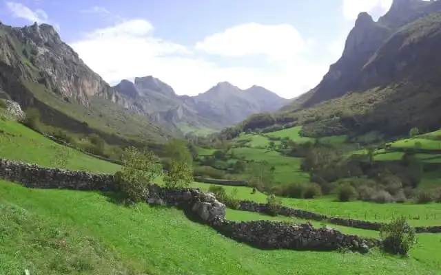
The trail starts from Santa María and takes us into the protected landscape, passing near the Braña de Sousas, famous for its stone ‘corros’. The path winds between stone walls (murias) that separate the harvested meadows, in an environment where it is common to spot chamois on the nearby peaks.
The final descent takes us to the town of Valle de Lago, in the heart of the park. It is a linear route that allows you to enjoy the transition between the port landscape and the closed valley.
Recommendations
As a 9.5 km linear route between two different points, it’s worth planning the return trip (two vehicles or organised transport) before setting out. With nearly 4h 30min of walking, about 200 m of ascent and a steep descent from the pass to the Sousas braña and Valle de Lago, it’s advisable to carry water and sun protection, since much of the route crosses open pastures and brañas.
Route
Waypoints
Guided experiences
Guided tours


Booked on GetYourGuide; each activity shows its cancellation policy.
Where to stay
Accommodation in Somiedo




The full Somiedo guide
Somiedo has its own website, with more detail than fits here:
Keep exploring


