

The route
Map and profile
- Ascent18 m
- Descent14 m
- Highest704 m
- Lowest682 m
Elevation profile (one way)
Use two fingers to move the map
Track based on OpenStreetMap (© its contributors, ODbL licence); elevation from the Copernicus EU-DEM model. For guidance only: always follow the waymarks.
About the route
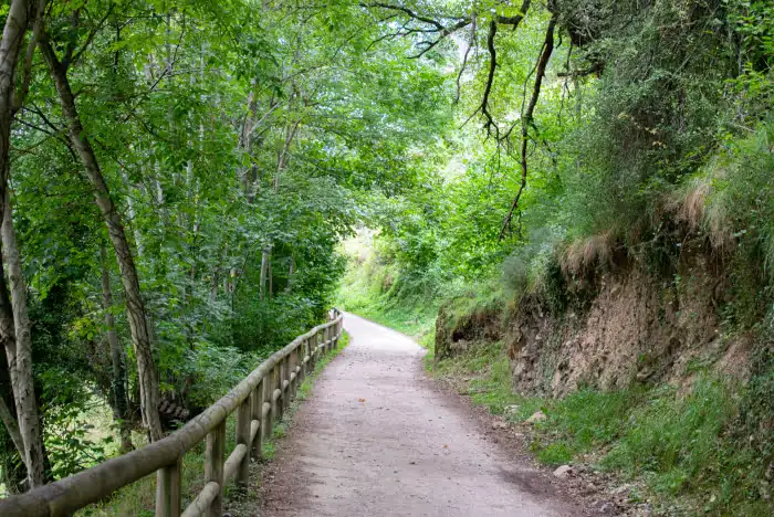
A walk with very gentle slopes (none steeper than 8%), asphalted at first and then on compacted gravel, ideal for all audiences. It follows the old road from Pola de Somiedo to Veigas, running parallel to the Somiedo River. Designed for people with reduced mobility, baby strollers and families.
Route Description
The Accessible Path is the most inclusive option in the Natural Park. It is an old rehabilitated road that connects the capital of the council, Pola de Somiedo, with the neighbouring village of Veigas.
The route has very gentle slopes (none steeper than 8%) and an asphalted surface on the first stretch and compacted gravel afterwards, which makes it suitable for wheelchairs, baby strollers and seniors. It runs parallel to the Somiedo River, offering a relaxing walk under the shade of riverside trees and with benches to rest.
It passes the Mirador del Río Aguino and lets you enjoy nature without any physical barrier. Ideal for stretching your legs or taking a family walk.
Recommendations
Being a short, flat route with only 30 m of elevation gain, it can be done all year round and doesn’t require technical footwear. Its asphalt or compacted gravel surface also makes it a good alternative on rainy days, when the park’s mountain routes lose their appeal due to mud.
Route
Waypoints
Guided experiences
Guided tours


Booked on GetYourGuide; each activity shows its cancellation policy.
Where to stay
Accommodation in Somiedo




The full Somiedo guide
Somiedo has its own website, with more detail than fits here:
Keep exploring


